2007: Colorado Backcountry Hiker Trip (July 15-20)

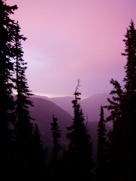
“I am a frayed and nibbled survivor in a fallen world, and I am getting along. I am aging and eaten and have done my share of eating too. I am not washed and beautiful, in control of a shining world in which everything fits, but instead am wondering awed about on a splintered wreck I’ve come to care for, whose gnawed trees breathe a delicate air, whose bloodied and scarred creatures are my dearest companions, and whose beauty bats and shines not in its imperfections but overwhelmingly in spite of them….”
I’d signed up with The World Outdoors because they seemed competent, had a good Web site, were affordable by me, and were going where I wanted to go with their Colorado Back country Hiker trip. I did some general Googling to see if anyone had anything bad to say, and couldn’t find anything. I picked the week of July 15-20 because it was listed as “singles,” which — trust me — I wasn’t going on to find a cute boy or anything. I just figured it would be more interesting in a family-free, couple-free group. Anyway, that’s how I ended up in this place, at this time, and with these fine people for six days of some of the hardest walking I’ve ever done.
Arrival/Day One: Vail/Hike from Fulford Campground via Iron Edge Trail to Peter Estin Hut
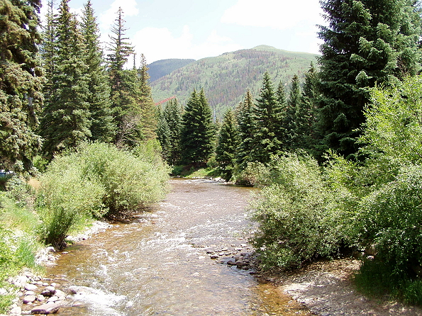
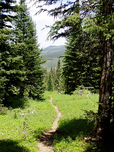
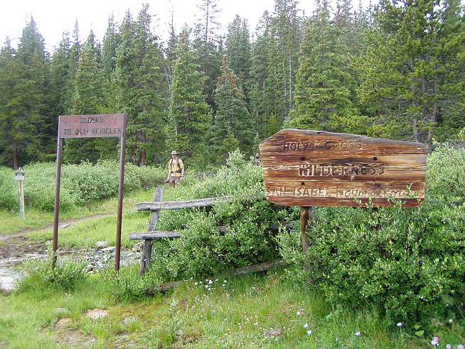
“Our group assembles in the sitting room of the Manor Vail Resort [changed when the Manor underwent renovations] in the heart of Vail Village at 9:00 a.m. After a short orientation and a shuttle, we lace up our boots for a day of hiking into the heart of the Rocky Mountains and the rooftop of America! Today’s trailhead begins in the White River National Forest at the Fulford Cave Campground. Exercise your lungs as we head up the Iron Edge trail for a great warm up hike to the majestically situated Peter Estin Hut.”
— from The World Outdoors’ hike description
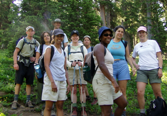
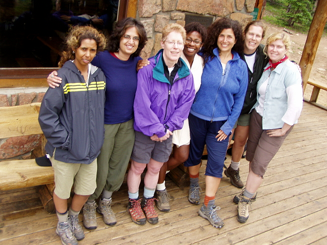
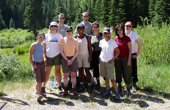 Here we are, bright, unbowed and uninjured. Some of us are standing on large boulders to, em, be more easily seen by the camera. Yeah, that’s it. The hiking party (clients, that is) consisted entirely of women, ranging from their 20s to their 50s. The exceptions: Rebecca, the intern on the far left front; and the two menfolk, our guides, Eric (left) and Mark (right) in the back row. Behind us is a large pond with some beaver dams; in front of us is a fair-sized parking lot, to our left is an outhouse which is one of the last chances we’ll have to um, have privacy before we get to the hut that night.
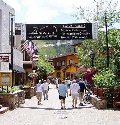
But back up a moment. Before we get to this group pose, a brief look at Vail, Colorado.
-

- In the town…
-

- And still in the town, which has a lot of quaint.
We’d been told we’d be picked up on the 20th by the World Outdoors guides just outside the Evergreen Lodge, and WO had arranged for a discount there, so it made sense to just bunk there for the night. If you have the option to stay there for any reason whatsoever, here is my advice: Think again. It wasn’t like saggy-mattress, moist towels, buggy bad, it was just crappy customer service, unimpressive amenities, a remote control that didn’t work and the inability to find a teabag for those of us who don’t drink coffee. Then again, there was a little “Welcome” sack in the room, which gave you a tiny bit of peanut butter, two bottles of water, a razor, some raisins and one or two other doodads.
So, after a night at the iffy Evergreen I headed down with my oversized backpack and joined a group of sturdy-looking women with whom I’d be hiking for the next several days. It would take me days to remember everyone’s name because I am completely hopeless with that kind of thing.
The guides showed up with a big white van and attached trailer and introduced themselves; we were all on board and heading into the mountains in no time. We passed Eagle airport (where I’d flown in; many in the group had instead flown to Denver and gotten a long ride through the mountains), into residential neighborhoods, then farms, until the track began too narrow for more than one vehicle and the right-side drop became seriously precarious.
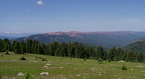
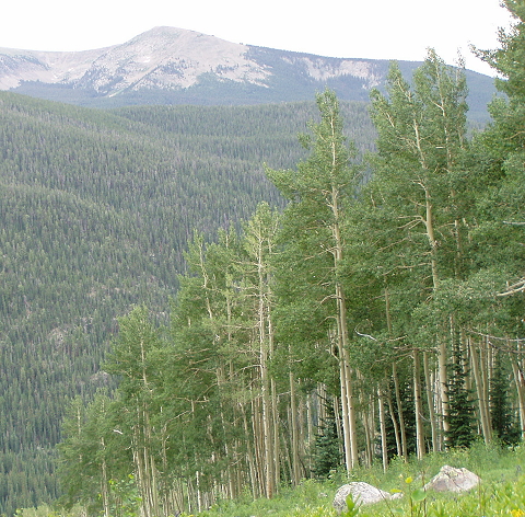
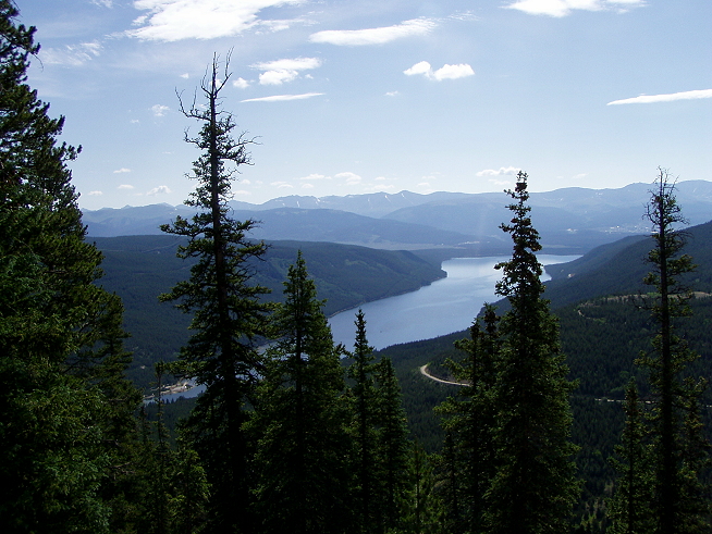
Let the hike begin! Now, the information had said that we’d be going 4.5 miles, with a 1700′ elevation gain. The weather was just gorgeous: Crystal blue sky, no clouds, no humidity, a light breeze, in the 70s. Conditions couldn’t be better for hiking. Except: We were approximately 10,000 feet above sea level, and I live in New York City, which essentially exists on sea level. I was on the altitude sickness pills, so I wasn’t really worried about feeling nauseous, and 4.5 miles is a hairball of a walk.
But I also haven’t hiked this high up before and I was about to have a very rude awakening.
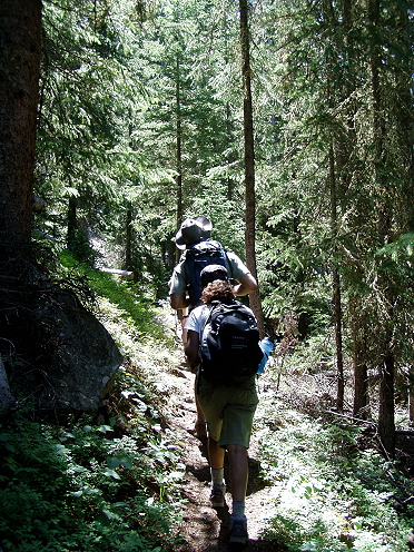 I actually started out leading the group, which I knew wouldn’t last because I don’t like being way up front like that, but I at least thought I’d have a say in the matter of dropping back. Nope. Pretty quickly a few women shot up front and one or two lagged in the back, but I spent most of my time in the soft back center of the group, huffing and puffing like there was no tomorrow. Unless you’ve done this, you can’t quite understand it — explaining just makes me sound like I have no endurance and that I’ve been a couch potato all my life. But I work out with cardio and weights six to seven times a week. I can do hiking. What kicked my ass was hiking a continual uphill … at 10,000+ feet. About every ten or fifteen minutes, after switchback after switchback, I would just have to stop and rest, whether the rest of the group was taking a break or not.
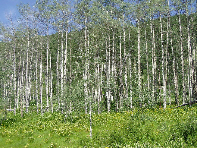
 We were in the midst of dense old-growth forest cut through with brilliant sun and the wonderful scent of evergreen trees. I’d like to say I took it all in and reveled the whole time, but not having breath to concentrate with made appreciation a little difficult. We would stop as a group here and there to snack on gorp or energy bars, sitting on fallen trees — there were a lot of fallen trees, which were cut through if they crossed the path, but a few we had to clamber over — and listening to everything. And then after just a few minutes rest we’d start up again and continue through the firs, the white Aspen groves and wildflowers until we were exhausted again and asking our adult equivalents of “are we there yet?” The reply was inevitably something like “not much further now” or “doing great” or “almost halfway there” or something incredibly noncommittal and — after a few days — annoying. As a relatively grown-up person I’ve discovered I like straight answers: If I say “how far along are we” and I know we’re doing 4.5 miles, I’d like an answer like “3 miles.” Not having any sense of how to pace myself wore thin quickly.
But I swore: No complaining. Back when I was younger and somehow ended up doing outdoor things I turned baby the first time I had to do something like pee at 3 a.m. and find my way to the outhouse in the dark. Or if I got cold. Wuss, seriously. Not fun at all. So for this trip: No complaining. Some sarcasm? You bet. But no wimping out, and no bitching. It’s a vacation! Suck it up!
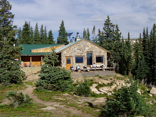
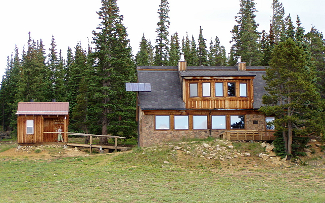
“A guide favorite, Peter Estin Hut is perched on a lofty knoll at 11,200 feet. This idyllic setting is the perfect place to relax and marvel at the magnificent views of the Elk Range’s jagged peaks.”
— from The World Outdoors’ hike description
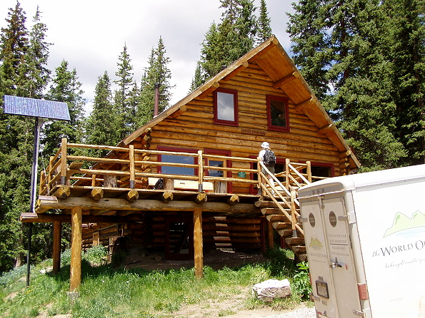
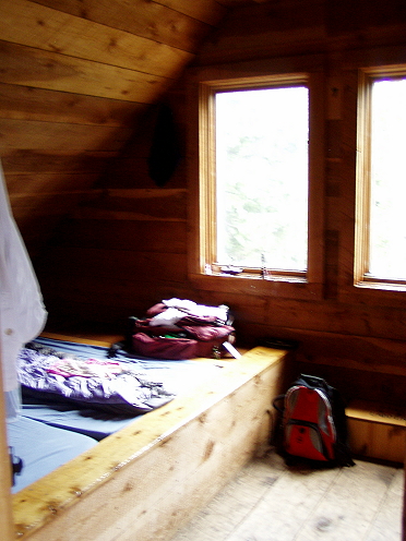
Now, this may just be local lingo, but folks: This is a cabin, not a hut in my estimation. I expected something a lot rougher and smaller; the Peter Estin Hut is just fantastic, rustic in all the right ways, clean and beyond all expectations. (The van on the right side had ferried our large sacks to the hut, and we just carried daypacks. Thank God for my Camelbak.) The solar panel you see on the left was there for things like lights in the evening and (I think) to keep the stoves going inside. But it wasn’t for heat — the cabin had a woodstove in the front parlor and that was it. The latrines were in a separate building behind this front entrance. The hut had three floors including a basement, and the front deck. The guides set out large water bags on the far left of the deck so we could have solar showers later, and we ate a lunch of salad, potato chips and cookies, with tea later on.
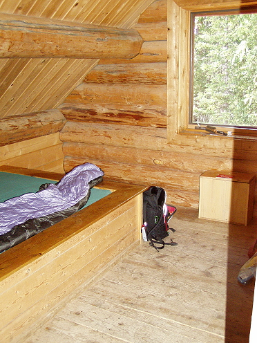
Inside, I managed to snag one of two single rooms for the night; we ended up staying here two nights and no one kicked me out, so I had it for two nights straight. Luxury! That’s my sleeping bag on the left and my daypack resting against the bunk. It was quite comfortable and I wasn’t chilled or overheated or anything, and no bugs bothered me. The hardest part was in needing to use the latrine probably four times that night.
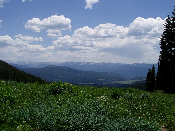
Here’s the view from the front yard area just outside the hut; those are the Elk Range mountains.
So because I’m a glutton for punishment, or just felt that I’d recovered enough to explore further, I went out walking again down a nearby trail with the woman who’d walked most of the day with me, Alison. We didn’t know if we’d get down this path the next day — the guides could be incredibly vague when they chose to be — and we didn’t want to miss anything. So we struck out not long after lunch.
 And almost immediately had our first wildlife sighting.
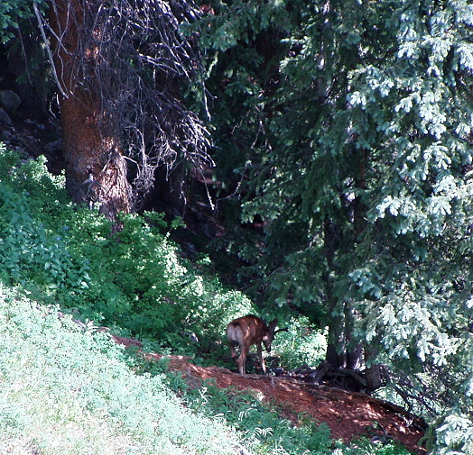 Okay, so, yes, it was just a deer, but we were impressed. Just to note again: Look at the angle of the landscape. We’re climbing up that, folks. Appreciate and honor our commitment!
We didn’t stay out long hiking; quickly we remembered how dreadful it was to have no breath, and feeling like you’re an emphysematic 80-year old is not a pleasant experience. So we got to the top of this hill with a lovely cliff side overlook and took a few pictures, then came back down again. Time to rest up and see if the solar showers were available yet.
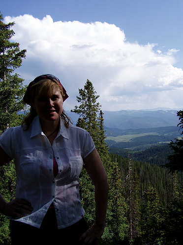 If I seem to have a worried look on my face, trust me, it’s no joke: We were slated to do 9 miles the next day, with 700′ up, and 2000 feet down — with an option to go another 4 miles.
No complaining!
Day Two: Hike from Peter Estin Hut via the Charles Peak Trail
 A little more worn, a little more casual, the lot of us hit the trail the next day. (That’s Alison out front; with the walking sticks is Nancy, the oldest of our group and the most amazing power walker — she just zipped through the whole trail with barely a pause and showed us young ‘uns a thing or two. More on that a bit later. So today, off we went up the same trail Alison and I blazed the day before, turning left and ascending past the point Alison and I gave up on, and completely missing our cliff side view, so I’m glad we did that.
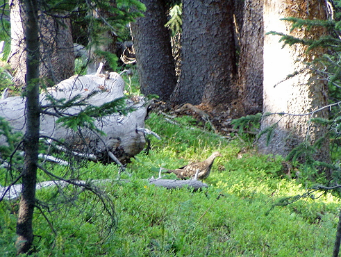
A bit more wildlife on the way: A grouse!
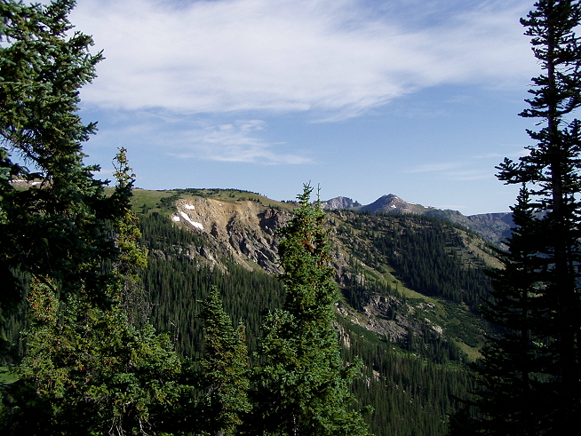
We were heading to the highest point on the trip: Charles Peak, which would be the most remarkable stop on the trip, though we’d have to work to get to it.
 “Hiking directly from Peter Estin Hut, our back country adventure continues when we climb a high elevation ridgeline at 12,000 feet just below Charles Peak.”
— from The World Outdoors’ hike description
 It’s still pretty hard going, but the scenery is varied and unusual, so it’s easier to keep wanting to go and go and go without too much rest; plus, you know there’s a spot at the top to aim for. (The whole vague “almost there” doesn’t really apply once you know that.) Also, once you get up here you notice the overall silence. There’s just the wind and the sounds we’re making. Down in the trees there’s a fairly constant sound of the branches and leaves brushing against one another, like the sound of distant, faint applause that never crescendos.
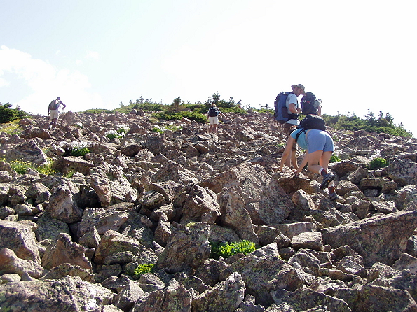
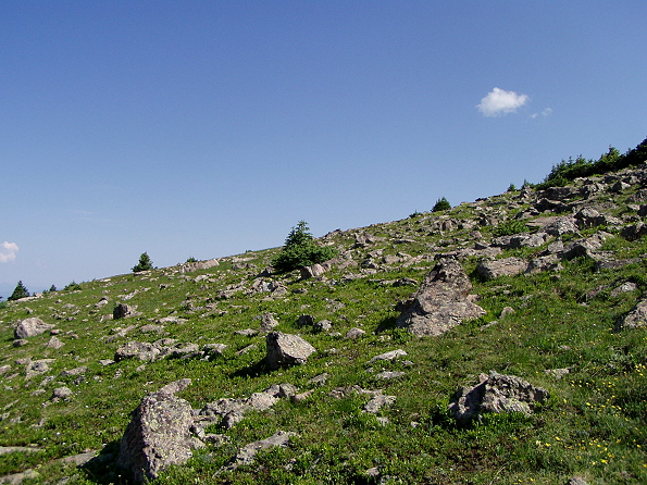 This is going to sound pathetically stupid, but all of a sudden, perhaps for the first time, I get why they’re called rocky mountains. Duh! Anyway, note the upslope, and how difficult the terrain becomes. But that’s nothing because pretty quickly….
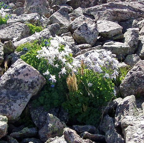
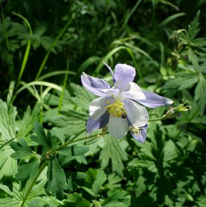
 Nevertheless, life finds a way…. I might be wrong but I think this is the columbine flower.
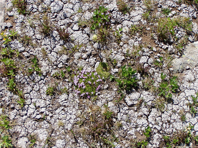
 Life finds a way, the sequel:
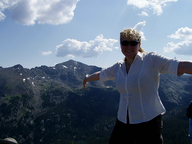
 And finally, the top!
And how do you know you’re at the top?
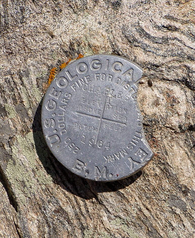
I promise, it looked like that when we got there, so nobody try to fine me $250.

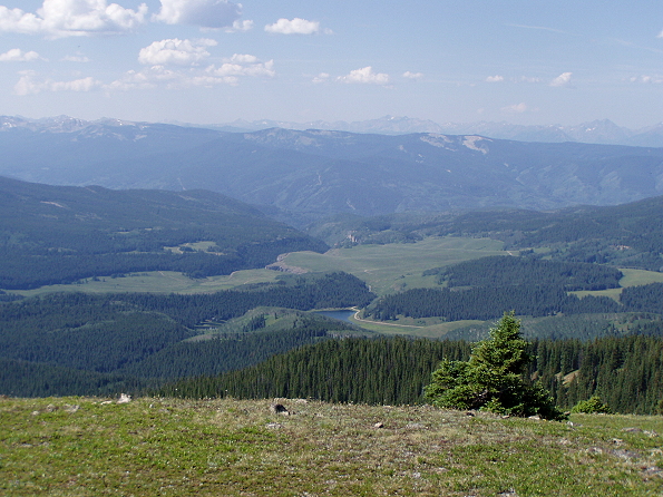
The view from above, down below.
We stayed up on the Peak for a while, taking a break and taking in the view. Photos can’t capture it, they’re a representation of reality but just like my trying to explain how difficult the climb is, it’s not the same if you’re not there. The size, the scope, the way all five senses are going full blast at once is tremendous. You look down into that valley (or at least I do) and start thinking about what it would be like to be down there, or to have a cabin down there, this cozy little openness amid all of those protective trees. You don’t think about the bear, or cougar or wildcat or whatever else might be down there, it just starts your imagination going and you think it’s a kind of Eden.
And then we started down.
 More wildlife checking us out:
 And every so often these twisted, dried out trunks of trees that I couldn’t help but think of as driftwood:
 You get the sense of the rocks poking through the green like bone showing through skin. Or skin through clothing, choose your less graphic notion.
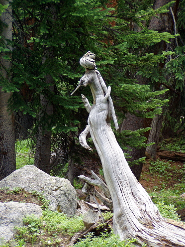
 The driftwood wizard casts a spell:
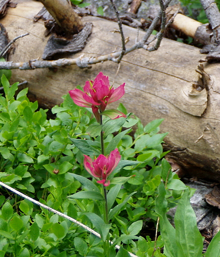
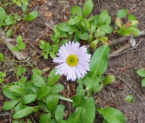
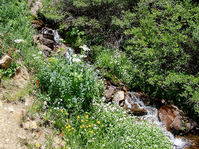
Indian Paintbrush. You can’t tell from these photos, but wildflowers are everywhere; this is peak wildflower season.
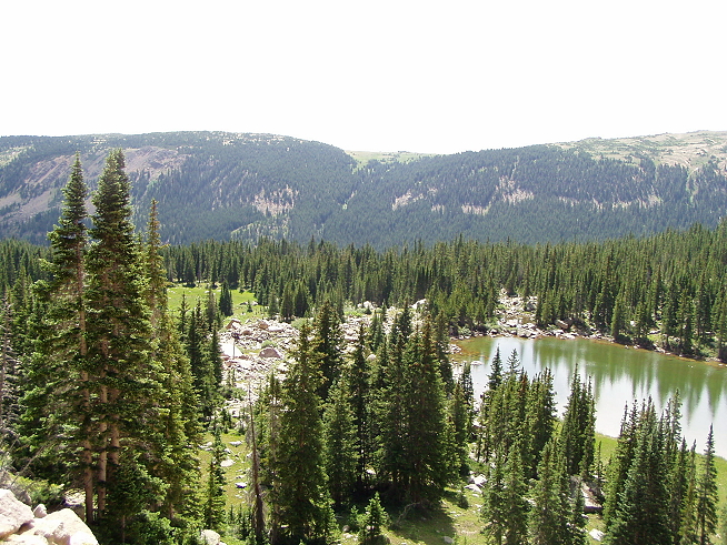
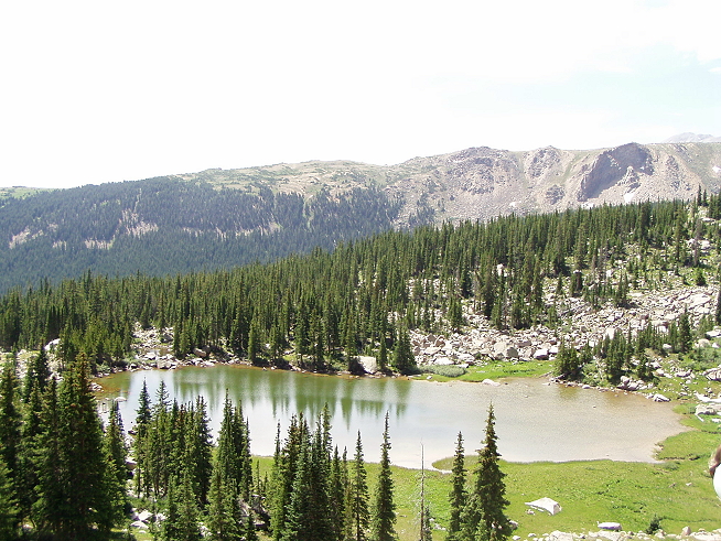
“Our picnic lunch spot is unforgettable as we gaze from alpine tundra out onto a sea of snowy peaks and a tranquil mountain lake. We then meander down tree covered ridges to pristine Lake Charles. After lunch we can venture on to Mystic Island Lake or explore Lake Charles, then we head down to Fulford Campground for our shuttle back to Peter Estin hut and another relaxing panorama-filled sunset.”
— from The World Outdoors’ hike description
 Welcome to Lake Charles, reached after a long descent through often marshy ground, passing over and around streams and creeks. One of our group slipped a bit on a rock and for the rest of the trip had to deal with a fairly bruised leg; it wouldn’t be the only injury. Just about everyone in the group had some sort of health issue by the time we were done — from those of us who discovered it was our time of the month to those with stuffed up heads to those with blisters to those with bruises. But nobody complained, that’s absolutely true. Anyway, here is the Lake, and you can see how the day was beginning to cloud up. This would set a pattern for nearly every day — towards about 3pm it would cloud up and threaten rain, thunder or even lightning, and then … nothing, at least until the last day.
 I said I would, and I didn’t back down: I went swimming in the lake here. Cold? You bet: It’s alpine fed water. I stayed in a good ten minutes or so — didn’t want to go out too deep because even the shallow parts had slick, mushy bottoms. Most of our group opted to go the extra four miles to Mystic Island Lake, but four of us stayed behind. In just two days we’d pretty well divided up into two groups of walkers, with some fluidity. There were Nancy (with her poles), Deborah and Alison virtually racing to get to some kind of finish line, and then there was me, Jackie and Saira taking our time in the back and trying to get a good sense of the view. We ended up calling ourselves the Sisterhood of the Hairy Legs. The others probably were having just as good a time making fast time, but we seemed to share a common need for general quiet, and a desire to really take everything in rather than a need for speed. So the three of us stayed back along with Angelina, who because of her bruised leg, tended to bring up the rear for the rest of the trip.
Both guides and Rebecca left with the first group, leaving us all alone at the lake.
We sunned on the rocks until there was no sun left, and then things started getting potentially ugly: clouds, lightning, wind, thunder. I had to wonder which was the worse plan if a thunderstorm came up for real — being out by a large water body, being out in the open, or being in the trees. All of them sounded like things I’d heard were bad ideas. But I started putting myself in Bear Grylls/Les Stroud mode and looked around for a copse of trees we could at least hang out in if it started to pour. Hell, I brought the Leatherman for a reason, and we were out in the wilderness, so why kid ourselves? Fortunately, we didn’t need shelter, because only a few drops came down and then Mark was back to lead us to the returned group, who were on the other side of the lake, waiting.

Shelter, if we needed it?
And off we went for the second half of the day’s trip, or what felt like the second half. We were starting to get to know one another better by this point, or at least know each others’ names better. There was one person on the trip I truly did not get along with, who was consistently loud and unamusing and really wanted the attention of the whole group no matter what went down. You can’t get along with everyone, and we’d had a mild tete-a-tete earlier in the day over a minor matter, and after she made a bizarre attempt at a practical joke (telling us returned hikers that they’d seen a moose and an eagle fighting) and then bossed everyone around about what (completely crappy) music we should play on the van ride back to Peter Estin that night, I just decided: You know what? She’s not on my trip any more. Probably just as immature as she was, but it was the only way I could keep from not actually throwing rocks at her later in the day. Sometimes a person just grates on you for no reason, or tiny reasons, and you can’t do a thing about it. I’m sure she found me just as obnoxious as I did her. So, no holiday cards exchanged there. (Based on later reactions from the others, I sensed she’d alienated more than just me by the time we all waved goodbye at the end of the trip, so I felt vindicated.)
There aren’t a lot of photos from this second half of the day, because it was almost entirely deep woods, and descent, and rocky. I was deathly afraid my knees weren’t going to do well and I tried to walk sideways, to lessen the impact, but that made it worse. I have in my notes that the 2,000′ of descent was “hellish,” and I seem to now recall that it was. The notes also say: “I did some of it in a sleepwalk; I was tired, I was tired of stubbing toes, I was annoyed by everyone and everything and now that we were in the old-growth dense forest there wasn’t much to see and so even the forest annoyed me. I was cranky and done.”
But again, no hissy fits, just do it and get it done. The closest I came to being verbally cranky was when Mark asked how we were all doing and I just firmly said, “I’m very tired.” Writing this now I see that I did pick up tidbits here and there about where I was and some information about the plantlife, but at the time — and still today, really — I feel like our guides were lacking. This was Eric’s first trip on this trail in this direction (he’d gone in the opposite direction on a multi-sport trip once), Rebecca was an intern, and Mark wasn’t all that familiar with the trail, either. If you wanted to know stuff, you had to ask and ask. I couldn’t understand why WO gave us people who can show us the way and can cook food but don’t really inform us about much. Not that I want the constant patter of a bus tour — God, that’s horrendous — but when we stop as a group for gorp or water or rest, some information about our area should be part of the guide.
When we got back to the cabin (the bus took us along the rocky road back to the hut) I tried to nap. We got tilapia for dinner, and s’mores for dessert. I wasn’t really very hungry — they fed us often and much — but it was delicious.
Day Three: Hike Henderson Park, Skinner Hut
“As you wake up and breathe deeply the fresh mountain air, get ready for another day of
the unique mountain beauty only Colorado can provide.”
— from The World Outdoors’ hike description
 Today turned out to be the best day of walking. There was a lot of steep up and down, but a lot of not climbing at all in-between, and the ascent/descent in those cases was gradual and easy. Or maybe I was just getting used to things. The ground covered was 7.5 miles, with 1200′ elevation gain and 1400′ loss, plus a long van ride over extremely rough, rocky road. Anyway, today we set out knowing there would be some wet walking.
I’d been wearing some amazing Kayland Vertigo High boots I’d bought just for the trip the past two days, but today I decided to see if these Salomon amphibious mesh shoes might work. I’d worn the Salomons on my previous hiking trips and they’d done fine, but the idea of the Rockies had intimidated me into buying serious boots. The Kaylands are great but got a bit heavy and confining after several hours on trail, and wouldn’t be as useful if wet was involved. So I switched, and felt reborn. Maybe that’s why this day of hiking was so much better!
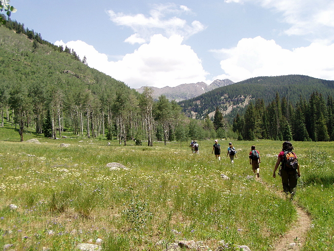
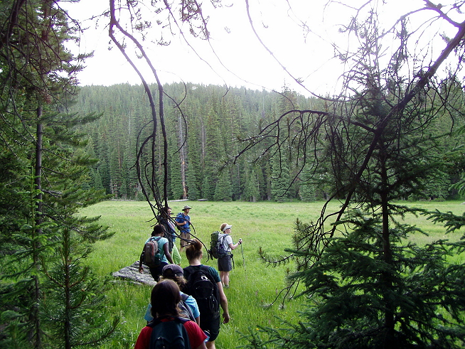
There was much walking across wide pastures and meadows, surrounded by thick patches of trees and more welcoming groves of aspens.
 The trail got a little spookier, though — Rebecca swore she spotted a cougar track, and then we started coming across these:
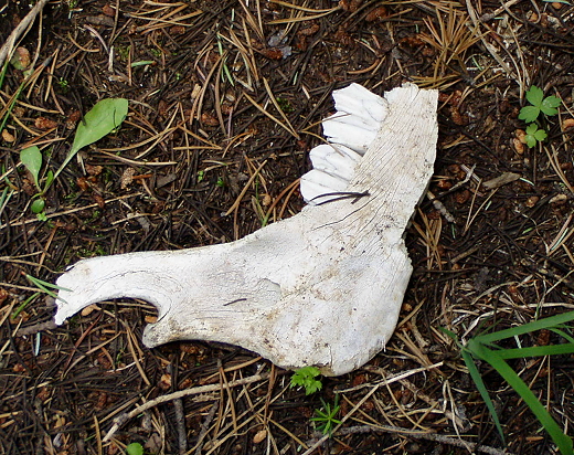
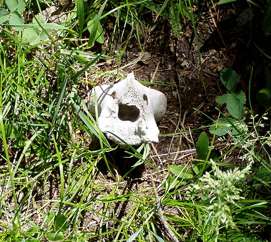
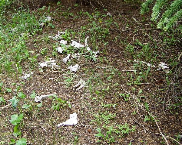
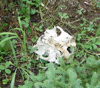
To be fair, it was noted that ranchers let their cattle graze around here and then round them up later, invariably losing a few along the way to natural deaths — and some unnatural ones — but these bones are quite picked clean and it’s hard to tell if they’re cattle or not.
At least, for me it is.
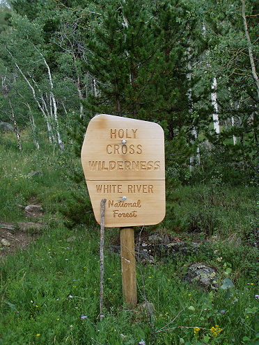
But then, the trail petered out. Eric and Mark just couldn’t find it. That happens, fair enough — trees fall, marshes spring up, and okay. We did a little bushwacking and backing up until we found the trail again, fording a stream here and there where necessary. Lunch was an awkward setup with little shelter from the sun and a lot of bugs. They called it a “Mediterranean” setup, but since none of us had blankets and the ground was questionable we had a hard time really enjoying it. Shortly after lunch, Mark turned back to get the van to meet up with us at a later trailhead, and Angela went with him — the bruising she took on her leg the previous day was making walking harder, so it made sense. After lunch, the rest of us went on a very steep, very long climb on the “Last Chance Trail.”
And finally came to Henderson Park.
“Today we venture deep into Holy Cross Wilderness and explore secluded meadows and flower-filled aspen woodlands on our way to magnificent Henderson Park, a gorgeous example of a pristine alpine meadow filled with flowers and a magnet for wildlife. One can not help but wonder how the first pioneers must have felt when they first saw these beautiful mountains and lakes. ”
— from The World Outdoors’ hike description
 Yeah, so it’s a big empty place. But it just pops up out of the middle of the trees and feels completely Edenic. Marshier than I expected — that smooth flat plain of grass is veined through with slight streams and soft areas — but this is an image I’ve had in my head for years. The photos, as I’ve said before, just can’t do it justice.
 I was deeply irked that we hadn’t had lunch here, because I wanted to spend a good hour just enjoying the place, rather than walking through it. But already the day was turning from sun to that threatening gray and we wanted to make sure we weren’t caught in too much rain if we could avoid it.
So we cut past the park without really getting into it, and lost the trail again. Nancy volunteered to help Eric scout it out, and the rest of us took a load off sitting just inside the treeline on fallen logs. Again, I’m all cool with the fact that trails peter out. I’m less cool with guides who take as much as 20 minutes to find them again.
Eventually, of course, we found it again.
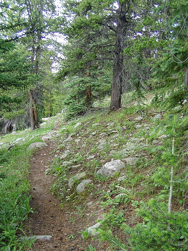 Note: This is a typical portion of the trail. Once again: The Rocky Mountains are justly named. Stones, boulders, split rock, chips, walls of granite shoot up everywhere, bubbling to the surface like lava. That’s what made Henderson such an ease on the eye, it was different, as well as pristine and beautiful. It was also the once place I wished we’d had quiet, but there was much jabbering going on — turns out that’s actually a good thing, because you really don’t want to startle any wildlife.
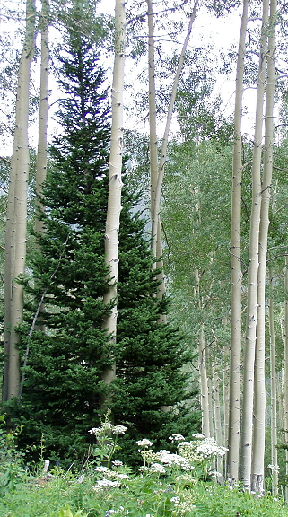
The last part of the day involved a long hike through a massive Aspen segment. What’s interesting about the Aspens is they crowd out nearly all other trees in the area, but early on you’ll see some mingling:
 To me, it looks like the spruce is hugging the aspen.
Here begins the grove:
I failed to take any real pictures inside the grove, it seems, but as we descended and were surrounded by them, their leaves flapping in the breeze like hands waving, I noted how some folks had carved into the tall white trunks over the years. And yes, that’s not good for trees, so a rap on the knuckles and don’t do it again. But since the markings were there, what was astounding is that among the initials and pithy statements were the years: 1953, 1966. And the trunks where the markings showed up weren’t all that high up, either, maybe eye level or chest level. It was a trip back in time, and slightly spooky to think about walking where so many others had. Also, reassuring: Fifty-odd years ago people weren’t any more thoughtful about leaving the trees alone than we are today.
So, we reached trailhead and the van with Eric and Angela, and exited Holy Cross Wilderness for the day.
 We boarded the trusty steed:
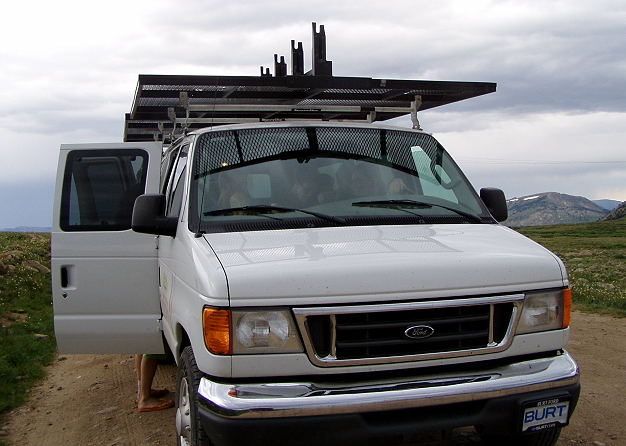
Nobody called it “Burt.”
We’re just outside the Continental Divide, a seemingly arbitrary marker that indicates the direction water runs — on one side, to the Pacific, on the other to the Atlantic. Me, I always picture the John Belushi film.
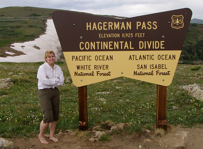
I had shoes off in the van. I rather like the idea that it looks like I hiked here shoeless. As we rounded the corner from this sign we looked back at the snowbank and wondered if anyone ever came out here to snowboard.
The ride in the van took about two hours to go a relatively short distance; the music inflicted on us by the louder of our group was the completely mediocre Jack Jones (the day before had been Ben Harper). I managed to slip in some Miles Davis for about 15 minutes, which was a relief. Fratboy rock tends to be annoying after a song or two, or bland as hell. It’s interesting to see what others think of as quality.
Just before we arrived we passed by Turquoise Lake; how it got its name we’ll never know, since the guides had no clue (actually, the link does explain). They did know to stop in a certain place to get this shot, but that’s it.
“This afternoon, we find ourselves at our next tranquil hideaway — Skinner Hut, probably the most precipitous site of any hut in Colorado. Blending well with the high, alpine landscape, this handsome stone building appears to have been carved from the underlying crags.”
— from The World Outdoors’ hike description
Not really a “hut.”
The view from the porch, off to the side.
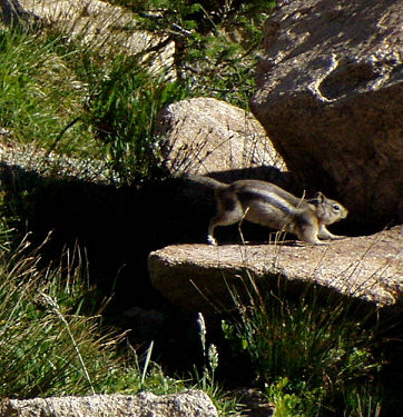
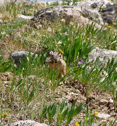
One of our local visitors, the ground squirrel with the markings of a chipmunk.
And some of the interior sleeping locations. The Sisterhood shared these three bunks side by side.
Dinner: Fajitas with fish, appetizers with turkey. And more s’mores!
Day Four: Free Day, Skinner Hut
“Today is all yours as we layover for a day to soak in the peace of the high mountains. The options are limitless. Relax at the hut, or lace up the hiking boots and head down the old railway grade of the Midland Railroad of the 1890s as we descend toward Turquoise Lake. En Route, we hike to the long since abandoned Hagerman Tunnel and explore the ghost town of Douglas City, once a wild settlement with eight saloons and dance halls.”
— from The World Outdoors’ hike description
 There were three options for today, but pretty much everyone decided we wanted to see a real western ghost town. And here it is:
 Er — not quite fitting the stereotype, that’s for sure. No dry, dusty roads, no creaky wooden buildings, no tumbleweeds. Not really even much of a ghostly feeling, just a lot of cleared open space and the inevitable rocks and boulders. This was as close as we got to a creaky old wooden building (there were a few others, all had trees growing inside the foundations):
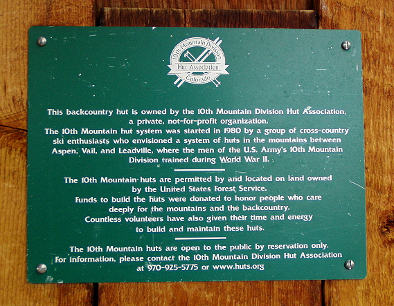
 Not disappointing — just different. Still, it was less Deadwood than Little House on the Prairie, and it’s hard to imagine it being a den of sin and depravity and rough and tough pioneer type folks. Yet, that’s exactly what it was. At least, according to the sign we found:
 This was a short, easy walk; it was a day off we had, but they gave us options of short hikes if we were interested, and as I recall everyone chose to come out to Douglass City. Two of us — Nancy and Alison, I think — hiked down the road and met the rest of us (in a van) at the bottom to begin the hike; they were really hardcore. According to our paperwork there was another option of a hike to Hagerman Pass and the Continental Divide; I don’t think anyone did that. We drove by the sign the day before and that turned out to be the only visit up there.
But this was more than enough for the day — listed as 6 miles and 1500′ elevation gain/loss. I think the 6 included the hike down to trail head, so we really only went about 4 miles for the whole day. But it wasn’t just about coming to Douglass City — we came to see what the inhabitants of the company town called Douglass City were building … and that came after a short hike out of the “ghost town.”
As we headed out of Douglass City I was once again in the back of the group; I caught Mark at the top of a slight rise and coming from a different fork in the road than the others had headed (they were going to the tunnel). I didn’t think much about it, just thought he’d either gone for a whiz or was scoping out another trail for us to take. This is called foreshadowing.
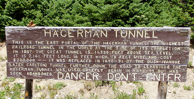
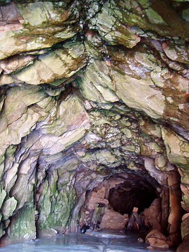
As you can probably guess, we didn’t pay a lot of attention to the “danger don’t enter” warning.
Here’s the tunnel from a ways back; hardly looks like more than a cave:
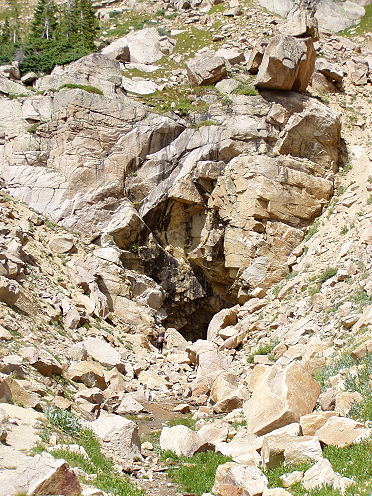 But then you get closer:
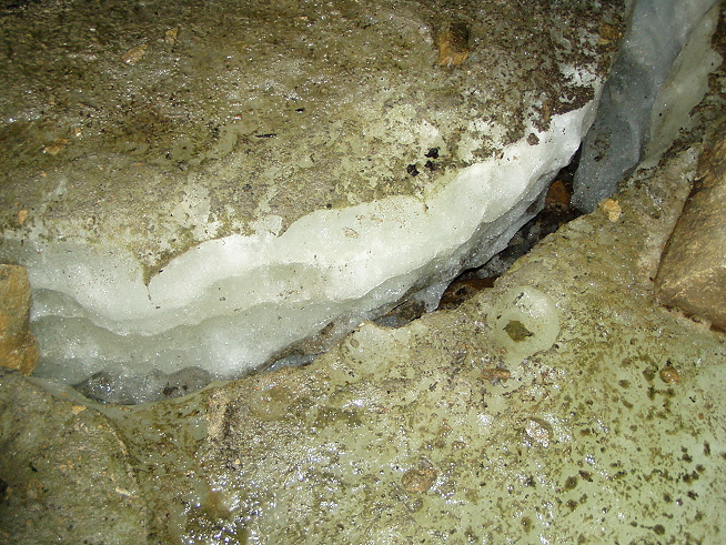
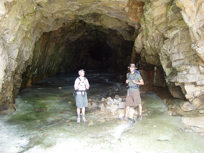 I also walked in the cave, which is floored with a complete sheet of thick glacial ice (with lots of bats in the back), but those photos just didn’t quite make it out.
 A fissure in the dirty, dirty ice:
 After the tunnel, we headed back down the fork I’d seen Mark emerging from earlier; this apparently was the area where the tracks were once laid, and it was a narrow cut between high rock walls. The feeling was like walking through a long hall, and immediately the guides started noting how this was the kind of place a cougar might hide out, ready to pounce. Suddenly, Mark turned and pointed to a mound of dark stuff on a rock at waist-high level, pointing at it with his knife. “Scat,” he said. “Clearly big cat scat.” Which on top of the print from the day before was unnerving. He said you could tell because — and here he cut it in half with the knife, making me hope he wasn’t using the knife to prepare dinner later — there were animal bones and things like that in the scat.
“But the only way you can be sure,” he said — and then popped a chunk of it in his mouth, chewing with glee.
We had a good second of collective disgust, punctuated with a lot of noises before we started laughing. It was a Clif Bar.
“Oldest prank on the trail,” he said.
And we went on.
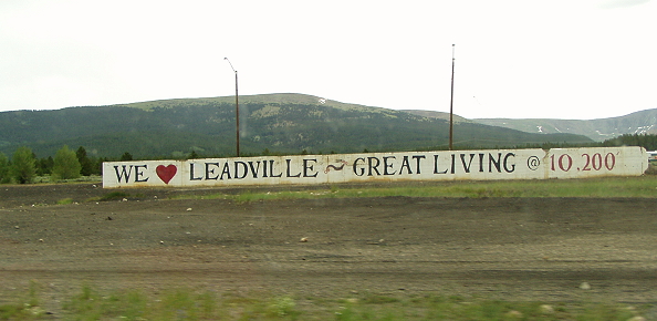
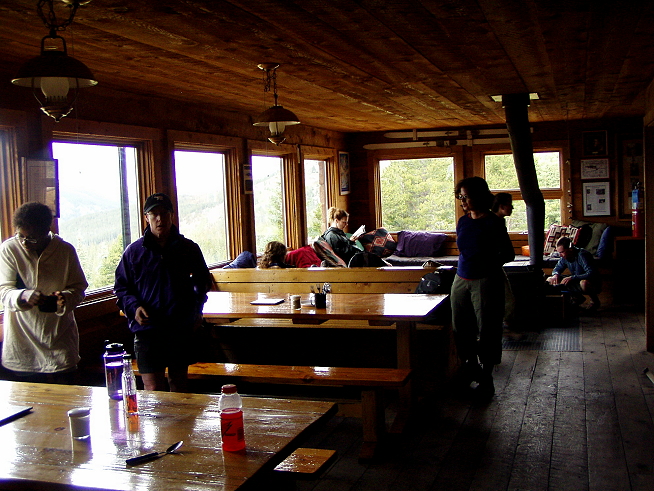
 Back at the Skinner hut, everyone pretty well collapsed on the sofas in front of the wood stove, or just outside. It was clouding up, being mid-afternoon, and the weather was turning. I was the only one who wanted to make the trip into Leadville with Eric, who had to pick up some supplies, so I took a shopping list from the hikers, who wanted booze, tampons (surprise!), and various other things. Part of my reason for doing this trip (well, perhaps a large part) is that I’m writing a story about the area, and part of the story takes place in Leadville, so I wanted to see the place for myself. According to the info there, Leadville is the highest … um, something in America. Town? It’s at 10,252 feet and to get to it, we had to take the van over those horrid bumpy roads and go very, very slowly until we hit tarmac. At least I got to pick the music, and Eric had decent taste, too, so the ride was pleasant enough — we went through Steely Dan and George Clinton. Eric noted how it’s the Colorado weather that tears up the roads; locals say there are only four seasons — winter, almost winter, almost over winter, and something else I can’t recall, but you get the gist.
 Leadville itself is actually fairly cool. I hadn’t known what to expect, though I thought it would be far more empty and desolate. Instead, there were some reasonably cute shops, a great bookstore (this was Harry Potter release weekend and so naturally Gryffindor had taken that store over). I wanted to find a cheap magnet for my mom and for one of the hikers, so I hit a few stores after Eric and I went to the grocery, and then we both got ice cream.
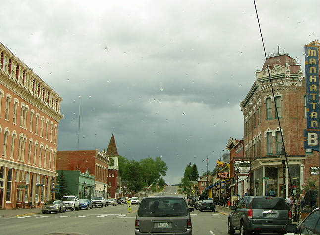 I dig that Leadville, Colorado has a “Manhattan Bar.” This, of course, is Main Street.
Back up in the mountains (heh) the weather continued to get progressively odder. We sat down to a lovely lavish dinner of grilled salmon and chicken, portabella and couscous with vegetables, then a chocolate fondue for dessert. Midway through the feast, someone looked outside the windows during dinner and noticed that the world had turned into a Prince song:
The sky was all purple.
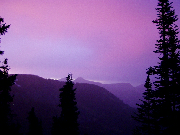
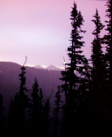
Sigh.
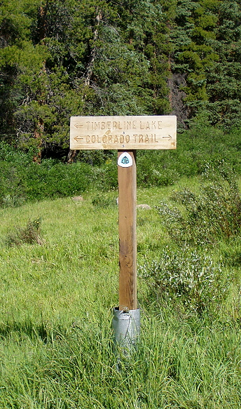
Day Five: Hike the Colorado Trail to Timberline Lake and Uncle Bud’s Hut
“Today we lace up our boots for a day of hiking along a portion of the 490-mile long Colorado Trail, which stretches from Denver to Durango in the southwest corner of the state. Our first destination is the shores of sun splashed Timberline Lake, set at the base of the Continental Divide. Permanent snowfields cling to the high, unnamed peaks surrounding this beautiful alpine lake.”
— from The World Outdoors’ hike description
 They warned us about today. And we knew it was coming: 5 miles to Timberline Lake, 815′ of elevation gain. That’s pie. Then: the Lake to Uncle Bud’s Hut via Bear Lake Trail — 4 more miles, with 1280′ feet of elevation gain and 500′ loss. It doesn’t sound like much. But most of the gain was done all at once. And according to my notes, “Today kicked my ass.”
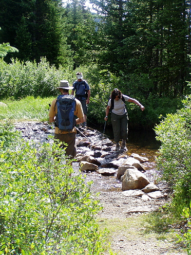 The first part wasn’t so bad — we took the Colorado Trail to Timberline Lake, and it was tough in places but despite my frequent puffing for air, I didn’t stop nearly as often. We crossed a few streams of wobbly, slippery stones. That’s Angela up there, braving the creek despite her injured leg. (By this point just about everyone had some form of injury or health issue going on; my main problem was a big old tumor who wouldn’t stop yapping the whole time, situated at the front of the pack, so basically I was doing all right.)
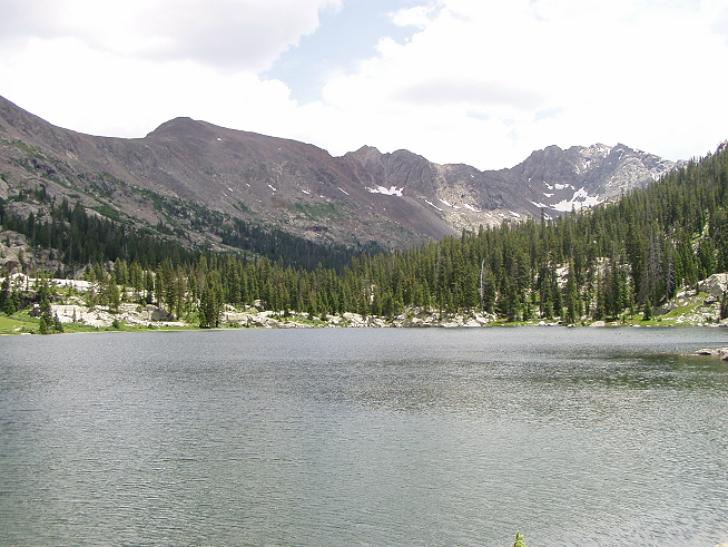
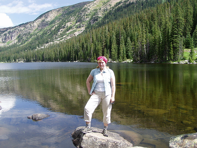 Aha, here I am, ass not yet kicked. I’m not doing a whole lot of smiling in these photos, I have to admit, but I was having a really good time. I think I’m just thinking about the ass kicking to come. So ignore me and look at just how pristine and lovely that lake really is. Probably not clear enough to drink, but beautiful. Several of us napped, while (if I recall correctly) Nancy went on a jog around the lake (a jog!) and the rest of us did a little wading in the water. Nearby a fisherman’s dog retrieved items from the lake, his barks booming through the canyon. Another small group of hikers with dogs (wearing carrying packs!) came trooping through at one point.
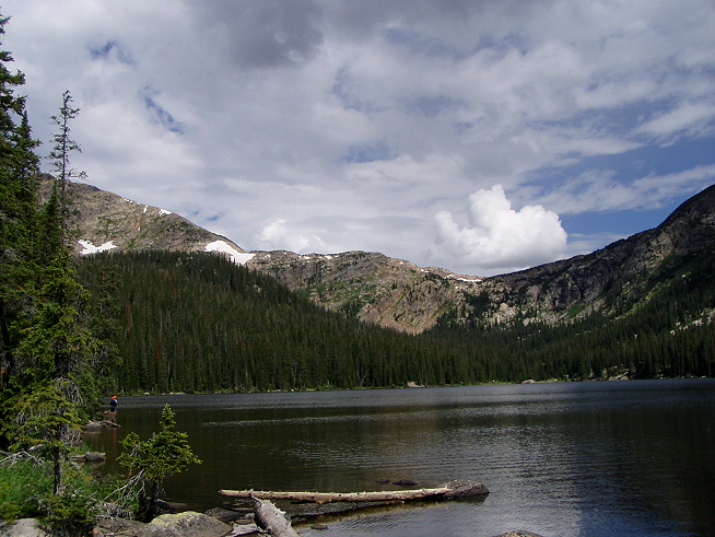
Note fisherman on lower left.
The clouds started coming in as we sat there, and I began to hope that it would teem down and we’d get back to the trailhead for lunch and have to take the van all the way to the hut. I hate being a wuss, but it did look like it was going to rain and, well … that day off was quite nice. But basically I knew I wasn’t getting out of this, and since there is to be no complaining I just sucked it up and decided this was going to happen so I might as well be on board with the plan. We had a brief lunch at the trailhead (which I never quite understood; they would feed us just before sending us on a big portion of the hike, and I usually just wanted a nap after that), thunder rolled in, it turned cooler and we donned rain jackets. Well, most of us did. I kept it off. The last time I had to hike in the rain (while hiking Hadrian’s Wall) I remembered quite clearly how hot it could get while wearing the North Face jacket I had, even if it did have a hood with a little brim. I decided the wet would feel good if it came, and I could put my jacket on later.
“After lunch, we climb through cool pine forests over a high mountain saddle before descending through a verdant valley peppered with colorful wildflowers Bear Lakes [sic] to an open meadow and Uncle Bud’s Hut.”
— from The World Outdoors’ hike description
 So, from my notes: This second part was “evil.” I just disappeared in my head for much of it, impervious to commentary or pep talks or anything. It was just pretty much constant up, up, up, and I fell into a thousand-yard stare pretty quickly. I just didn’t think of anything besides song lyrics, pushing hard. And, of course, it rained. What a surprise there are absolutely no pictures from this part of the hike; I think I’d forgotten I even had a camera.
Finally, with one last push up a hill (I seem to have forgotten any sense of “descent” during this part of things), we came to Uncle Bud’s Hut.
Also, not a “hut.”
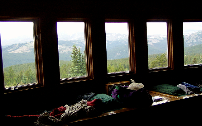
The view from upstairs, out that bay window.
And the room Jackie and I shared.
The interior of the hut.
The pristine big sky view from the front of Uncle Bud’s.
We all were quiet that evening, just kicking back with brie and crackers and grapes and cocoa. I even had cell service and checked messages for the first time in a week. Then I curled up and did some crosswords and napped and felt very, very settled.
Day Six: Hike Tennessee Pass from Uncle Bud’s Hut via the Colorado Trail
“Beginning right at the front door of Uncle Bud’s Hut, we venture once again into the heart of the Holy Cross Wilderness and along the renowned Colorado Trail. With breathtaking ridge-line passes, beaver-pond meadows, craggy peaks and a trail’s end that straddles the Continental Divide at Tennessee Pass, today is truly a fitting finale to a wonderful week.”
— from The World Outdoors’ hike description
Us, five days after the start.

They made us bacon for breakfast, among other yummies. But: Bacon. Everybody loves bacon.
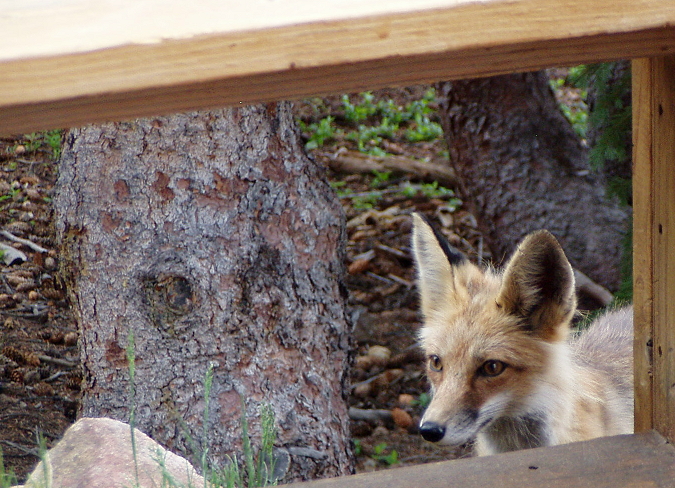
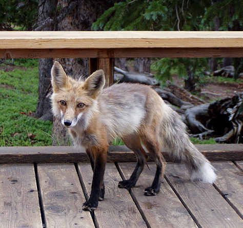
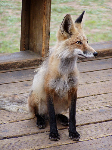
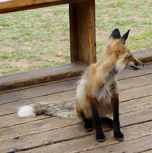
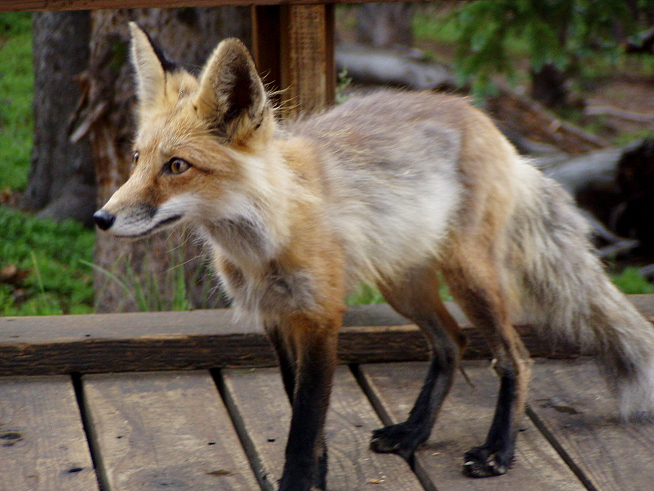
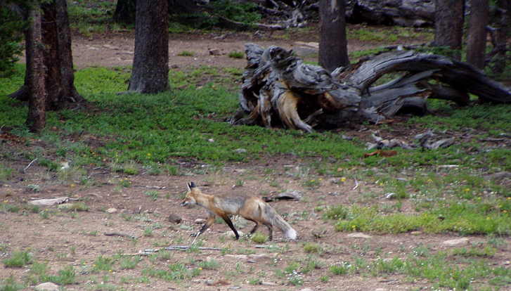
Everybody. This little guy showed up while I was out taking that vista view I featured in yesterday’s lineup; Jackie and I had seen him from our upstairs window but then figured he’d left, so I went out to take pictures and caught him again.
-

- This is another one of those “don’t carve on the trees” moments: Yes, you shouldn’t do it and you’re sorry others have, but how much greater is this trip because we had a semi-tame fox come sniffing around? I really love the way foxes look, these rangy little wild dog-like creatures, so I took a lot of photos. But as Eric and Mark pointed out, the fact that he came up and was so fearless was a bad sign — it meant others had fed him and now he came expecting to be fed, which meant he was less able to adapt to the wild. We didn’t feed him. Just stole little bits of his soul.
And right after breakfast, we were off again. The weather was now officially overcast, and threatened rain, so we wore our jackets (even me this time). I think our hearts were gone out of it now; we were ready to be done and finished. It was sad and gratifying at the same time, but we were ready for real showers — not solar ones — and to not have to walk multiple miles up and down all day. Today’s distance was 8 miles, with 400′ elevation gain and 1300′ loss, so there was a lot of down, down, down, mostly through dense, thick forest
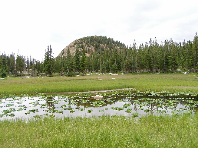
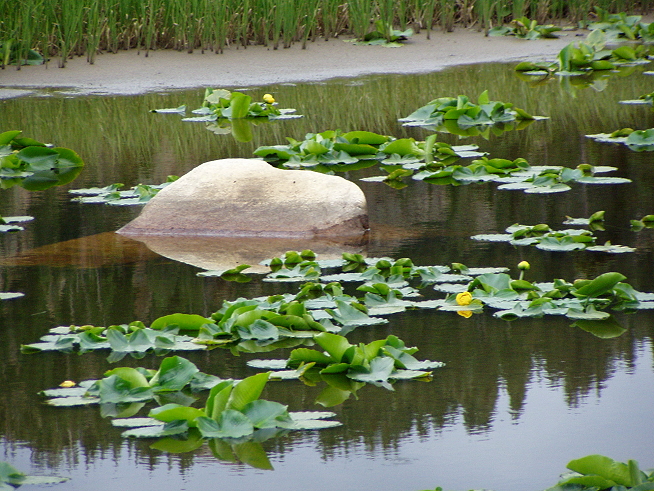
 Again, the terrain shifted all the time. We passed by this lily pond; someone mentioned that the rock peeping out of it looked like a polar bear’s head.
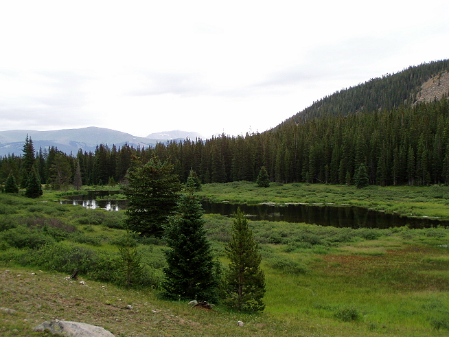
Another pond at a distance:
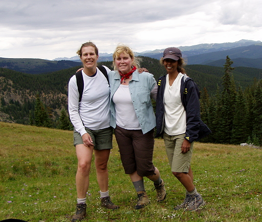
The Sisterhood of the Hairy Legs, assemble!
Look at that dork in the middle with her socks pulled up! Gah. Still, the bugs were biting. you really wanted to be covered up. On some of that downhill they simply were swarming, despite the wet (or maybe because of it) and I was spraying Deep Woods Off like it was hairspray.
And then we headed home.
Epilogue: A bunch of us staying at the Evergreen met up for greasy snacks and drinks after we’d cleaned up and gotten organized; Jackie and I wandered around Vail afterwards to decompress and go over the trip. Overall, World Outdoors does a great job. The nitpicky stuff I came up with is just that — nitpicky. I mean, nobody got lost, nobody got really hurt, and we were really traveling in general comfort. I think that the trip could be improved, and told them so, but I would recommend them to anyone thinking of this kind of trip. They do offer other trips, just check out their Web site. And get out in the outdoors! It is quite something to discover your limitations, and exceed them, and get to capture some outstanding scenery at the same time.
Now I have to go and rewrite the book.
xo,
R